Geographical Schema
A geographical schema is a common object in the 1C:Enterprise language. It is one of the mechanisms for generating economic and analytical reports and allows us to visually analyze data in terms of their geographical location.
Geographical Schema Structure
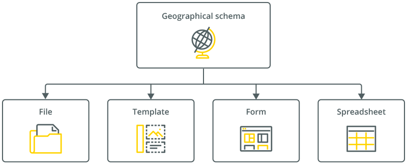
A geographical schema can be added to a form or a spreadsheet document. We can either add a geographical schema to a template or save it to a separate file on disk:
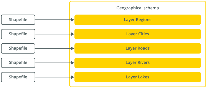
Geographical schemas are based on shapefiles that contain topological data. To create such shapefiles, use programs of the ESRI ArcGIS family.
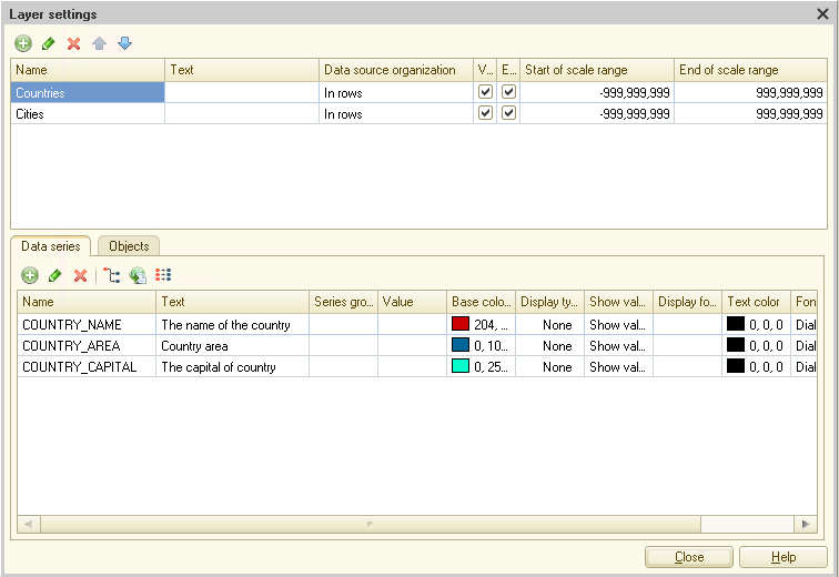
Each shapefile contains topological objects and their associated data. A geographical schema allows a shapefile to be read as a layer. Thus, the schema is a set of layers, where each layer is a collection of homogeneous topological objects and associated data:
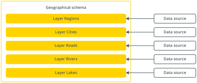
For a geographical schema to display the data obtained as a result of calculations, each of its layers can be associated with a separate data source:
Data Presentation
As a result of connecting data with the schema layers, each topological object in every layer gets assigned specific values, which can be displayed in the diagram.
Geographical schemas support the mechanism of providing details. Thus, double-clicking on any topological object brings up a report referring to such an object. For example, it can be a sales report for a specific region:

As users can decide what has to be displayed on each layer in a geographical schema, they can change the number of details, composition, and nature of displayed information. For example, choose to display data in the context of cities, and not as a histogram but as shapes of various sizes.
Interactive Configuration Options
Geographical schemas offer extensive interactive customization options that can be used both in Designer mode and in 1C:Enterprise mode. Developers can manage the layers of a geographical schema, change the visibility of existing layers, and add new ones:
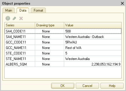
It is also possible to view and modify the data associated with individual objects of geographical schema layers: